DK 2020新书 气候紧急情况地图集 Climate Emergency Atlas

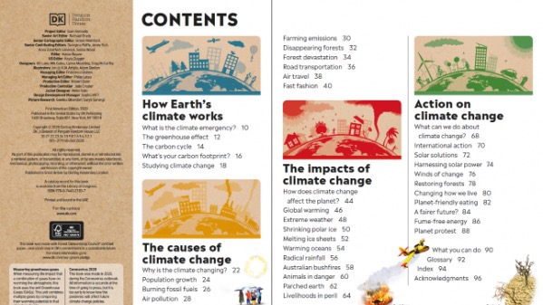
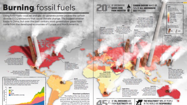
我们的房子着火了-是时候为早醒来面对地球面临的气候危机了。 这个独特的图形高度告诉您有关气候变化以及我们可以采取的措施。 哪些国家的二氧化碳排放量最高? 哪些沿海城市最容易受到海平面上升的影响? 十年后极地冰盖会是什么样? 哪些国家成功利用了可再生能源? 气候紧急情况地图集囊括事实,数据和30多个动态地图,清晰易懂,是所有年轻气候活动家的理想参考指南。
Our house is on fire–it’s time to wake up to the climate crisis facing planet Earth before it’s too late. This unique graphic altas tells you everything you need to know about climate change and what we can do to turn things around. Which countries generate the highest CO2 emissions? Which coastal cities are most vulnerable to rising sea levels? What will the polar ice caps look like in 10 years’ time? Which countries have successfully harnessed renewable energy sources? Packed with facts and figures and more than 30 dynamic maps, Climate Emergency Atlas is clear and easy to understand, making it the perfect reference guide for all young climate activists.

我的小孩的成长分享 » DK 2020新书 气候紧急情况地图集 Climate Emergency Atlas